New Zealand travel Lonely Planet
Tourist & visitor driving theory quiz
In October 2019 there was an introduction of a NZD$35.00 International Visitor Conservation and Tourism Levy (IVL).
This charge is to help supply facilities for people visiting our beautiful country.
Along with the IVL there is a new electronic process for people visiting from visa waiver countries called the NZeTA, New Zealand Electronic Travel Authority. Visitors can now request an NZeTA for any travel after 1 October 2019 by applying online at www.immigration.govt.nz/nzeta.
The NZeTA will cost NZD$9 via the mobile app and NZD$12 through the website. At the same time that a visitor requests their NZeTA, they will be charged the new NZD$35.00 International Visitor Conservation and Tourism Levy (IVL).
The NZeTA request takes less than 10 minutes to complete and will bring New Zealand’s border control into line with international best practices, with the United States, Canada and Australia already having electronic travel authorities.
Our Country
New Zealand has a population of around 4,900,000 an unemployment rate of 3.9%.
Goods and Service Tax (GST) of 15% is placed on all purchases at the time of sale.
Total land mass is 268,021 km² with around 15,000 kilometres of costline said to be the 9th longest in the world.
The two main islands are named the North Island or Te Ika-a-Māui and you guessed it the other is the South Island or Te Waipounamu, Stewart Island or Rakiura is the third-largest island of New Zealand. It lies 30 kilometres south of the South Island, across the Foveaux Strait. Its permanent population is 38.
Auckland is the largest city and Christchurch in the South Island is the 2nd largest.
Wellington is the capital of NZ and the 3rd lagest city.
Just under 4 million visitors stepped onto New Zealand shores in the 12 months leading up until March 2018, this is an increase of 40% since 2013.
So as you see NZ has become a very popular place to visit and to help our beautiful country remain green and clean as well as improve the traveller experience new charges have been introduced.
The North Island is mainly made up of coastal plains and small mountain ranges. The main volcanic mountains in the North Island are : Mount Tongariro (1 967 metres), Mount Ngaruahoe (2 287 metres), Mount Taranaki (or Egmont) (2 518 metres) and Mount Ruapehu, the largest, at (2 797 metres)
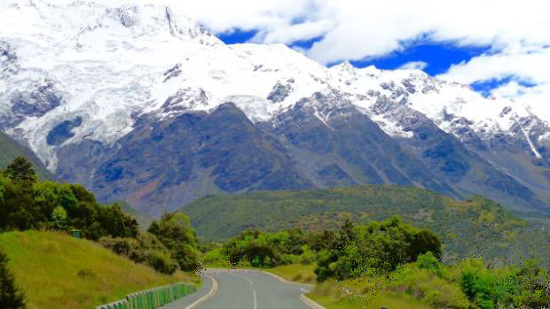
In the South Island, it is the higher Southern Alps which run the length of the island. The Southern Alps count 360 glaciers, of which the largest are: the Tasman, Murchison, Mueller, Godley and the Hooker glaciers. These five are situated on the East coast of the South Island. On the West coast, the largest glaciers are the Fox and the Franz Josef glaciers.
At least 223 named peaks in the Southern Alps are higher than 2.300 metres. Some of the highest mountains or peaks in the South Island are : Torres ( 3 163 metres) Teichelmann (3 160 metres) Sefton (3 157 metres) Malte Brun (3 155 metres) and Haast (3 138 metres).
Mount Cook (or Aoraki, in Māori), in the South Island, is the highest mountain in New Zealand (3 754 metres). The largest lake is Lake Taupo, and the river with the greatest flow is the Clutha. The longest river in the North Island is the Waikato.
New Zealand has a maritime climate, affected by latitude and the proximity of the ocean. The country's mountain ranges, and in particular those of the South Island, create different climactic conditions between the North and the South Islands. The Southern Alps also form a climatic barrier between the east and west coasts of the South Island. "Click here for more detail"
The North Island has a generally more temperate climate, while winter conditions in certain areas of the South Island may drop to near arctic conditions. New Zealand's weather is inclined.


